
Pakistan Provinces map consists of four major provinces of Pakistan. Punjab , KPK, Sindh, Balochistan are the four major provinces of Pakistan. Each province has its own language, culture and tradition. Furthermore each province has its own literature, architecture and games. Their way of way are also different. In this blog we will discuss the Pakistan provinces map as well as we will see talk about other elements including language , tradition and about the people.
Asif Ali Zardari is the current President and Shabaz Sharif is current Prime Minister of Pakistan.
Table of Contents
TogglePakistan Provinces Map
Pakistan provinces map consist of 4 major provinces of Pakistan including FATA which is now merged into KPK we will also talk about the Gilgit Baltistan and Kashmir region.
Punjab
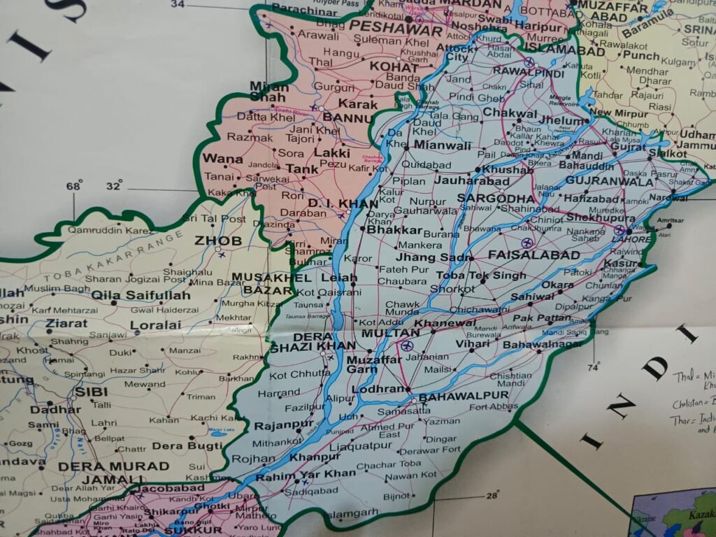
Pakistan provinces map is incomplete without Punjab province. Punjab means “Land of Five Rivers.” Punjab is the most densely populated province of Pakistan consisted on 9 provinces, 36 districts and 141 tehsils. This province enjoys the beauty of lush green fields, agricultural land, the largest Salt mine, the flow of five mighty rives including largest river of Pakistan Indus river.
The area of Punjab consist of 206,251 sq km. Population of Punjab as per the latest census is about 127688922. The population density is 621.8/sqkm.
In the north the Punjab is surrounded with KPK and capital city Islamabad. In the North East Kashmir region is located and in South East India is located. To the South West Sindh province is located and in the North West Balochistan is located.
Lahore is the capital city of Punjab which is also the historical city. Many famous Mughal Emperor including Aurangzeb, Shah Jahan is buried there.
Faislabad is the second largest city of Punjab. It is also famous for textile products.
KPK
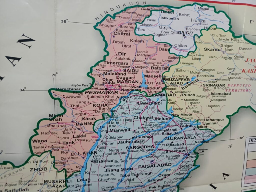
KPK is formerly known as NWFP( North West Frontier Province). Pakistan provinces map is incomplete without this land. This province is the habitant of Pathan. The land of brave people consisted of many rivers including the largest Kabul river which enters from Kabul and meet with Indus at Attock City.
It is surrounded by Afghanistan to the west. From the East side it is covered by the Kashmir region. In the South it is contained by Punjab province
It has the area of 74,520 kmsq. The population of this province is 35.53 million. It has also got 9 administrative divisions with 34 districts.
Peshawer is the capital city of KPK and also the largest city of KPK.
Balochistan
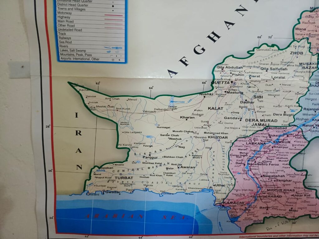
Balochistan is heart of Pakistan provinces map which is the full of natural resources. Any how the province lacks the infrastructural developments. North and West region shares border with Afghanistan and Iran. East shares border with Punjab and Sindh while west is surrounded by Arabian Sea.
This is the largest province of Pakistan with lowest population density. The province comprises 347,190 kmsq with the population of 12.34 million. The lack of basic needs remain the top priority of every Government but the rugged land and hard terrain is the major hurdle in development. The people are not well off. Tribe system is still the part of Balochistan.
Anyhow this province shares the costal area. The Gawadar port is the part of this province which is now the hub of CPEC(Chine Pakistan Economic Corridor). It is one of the deep port of the world. Major developments are taking place in that region which includes building infrastructure and economic zones.
Sindh
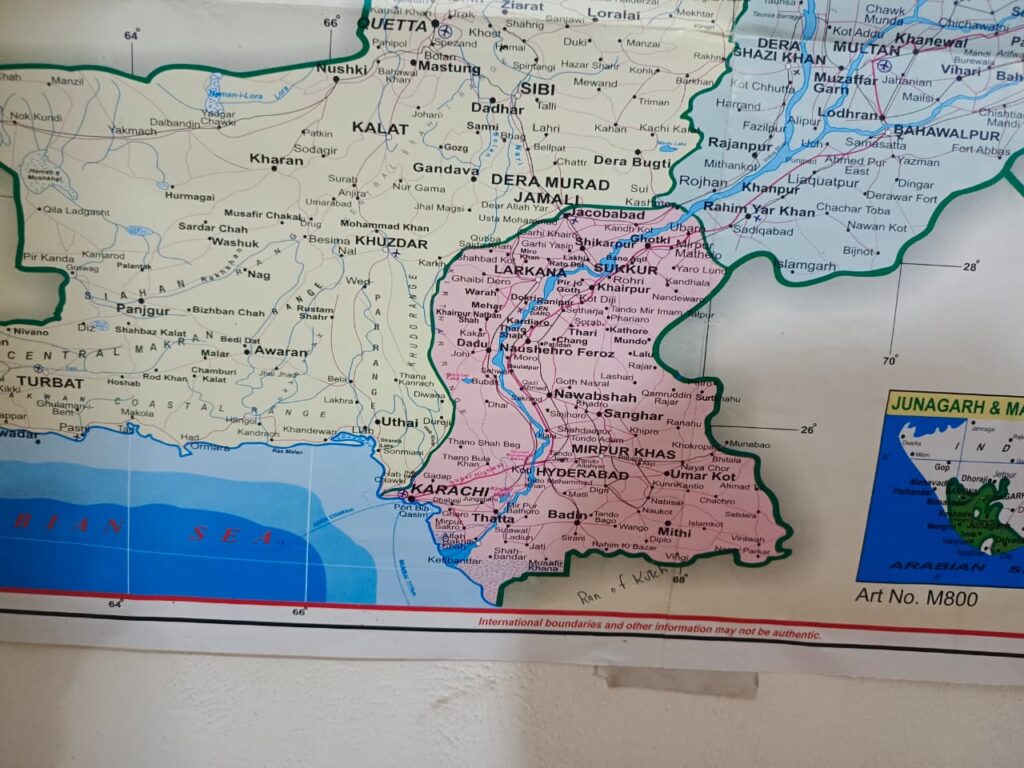
Sindh is the most populous province of Pakistan. Karachi is the largest city and capital of Sindh. Karachi is the 12th largest city of the world as per population Statistics. Sindh is also called half of Pakistan in local language. Sindhi is the most spoken language of Sindh.
The population of Sindh is 47.89 million and area was this is the third largest province of Pakistan. Mostly people of this province are related to Sea food.
In Pakistan provinces map this is province has very much importance because this land provides the Sea Route to Pakistan with the rest of the world.
Gilgit Baltistan
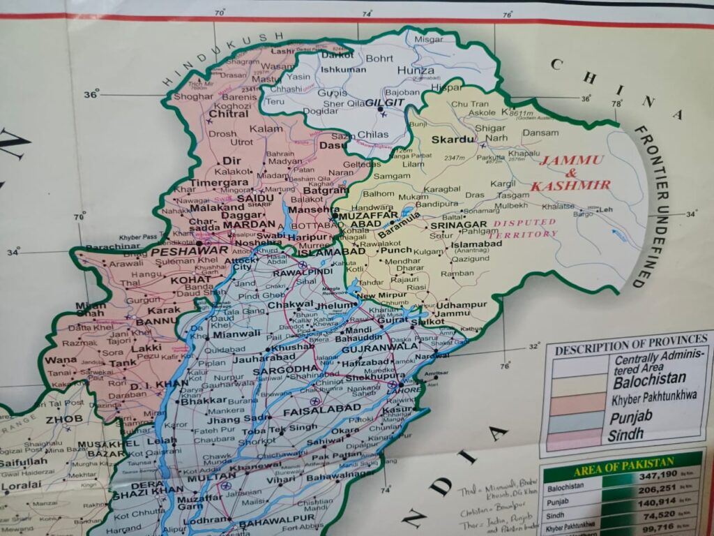
Gilgit Baltistan complete the map of Pakistan. It is located in Northern region. The mighty land is home of 5 mountain peaks which got the height of above 8 thousands. These peaks are famously known as Eight Thounsanders in Pakistan. Skardu and Gilgit are the major cities of these provinces. Gilgit Baltistan has the area of 72,971kmsq.
The GB is famous for lush green mountain area. Many people not only from Pakistan but across the country visits the place. This area is one of the important part of Pakistan Provinces Map.
